Geoparks are the basis for the integrated conservation of ecosystems, culture and the development of ecotourism in the Kyrgyz Tien-Shan
The Tien-Shan Geological Society is one of the first organizations in Kyrgyzstan to work on a concept for the organization of Geoparks.
If we talk in terms of the criteria by which UNESCO evaluates Geoparks, the Tien-Shan is a global, unified Geopark. It is difficult to overestimate the uniqueness of the Tien-Shan. The geological heritage of the Tien-Shan is one of the most diverse in the world.
It presents stratotype geological sections, outstanding landscapes and individual aesthetic landforms. There is a close relationship between geological diversity and cultural heritage.
It is not fair that in Kyrgyzstan, in the presence of vast geodiversity, there are still no officially recognized objects of international importance.
Experts are convinced that several specific territories within the Kyrgyz Tien-Shan clearly claim the status of UNESCO Global Geoparks. In these territories, geological sections are presented, demonstrating significant periods of the history of the Earth. There are magnificent natural monuments of incredible beauty, the uniqueness of which goes beyond national borders, which defines them as natural monuments of world importance.
Project relevance
Geopark is a region that has a complex special protected status, on the territory of which the geological history of the Earth, the formation of local landscapes, expressive geological formations, and layers of fossil fauna are clearly revealed. A geopark is not only a geological heritage, but also a habitat for biological species, interconnected ecosystems, a cultural and historical heritage. A Geopark is a favorable environment for the development of ecotourism and related businesses.
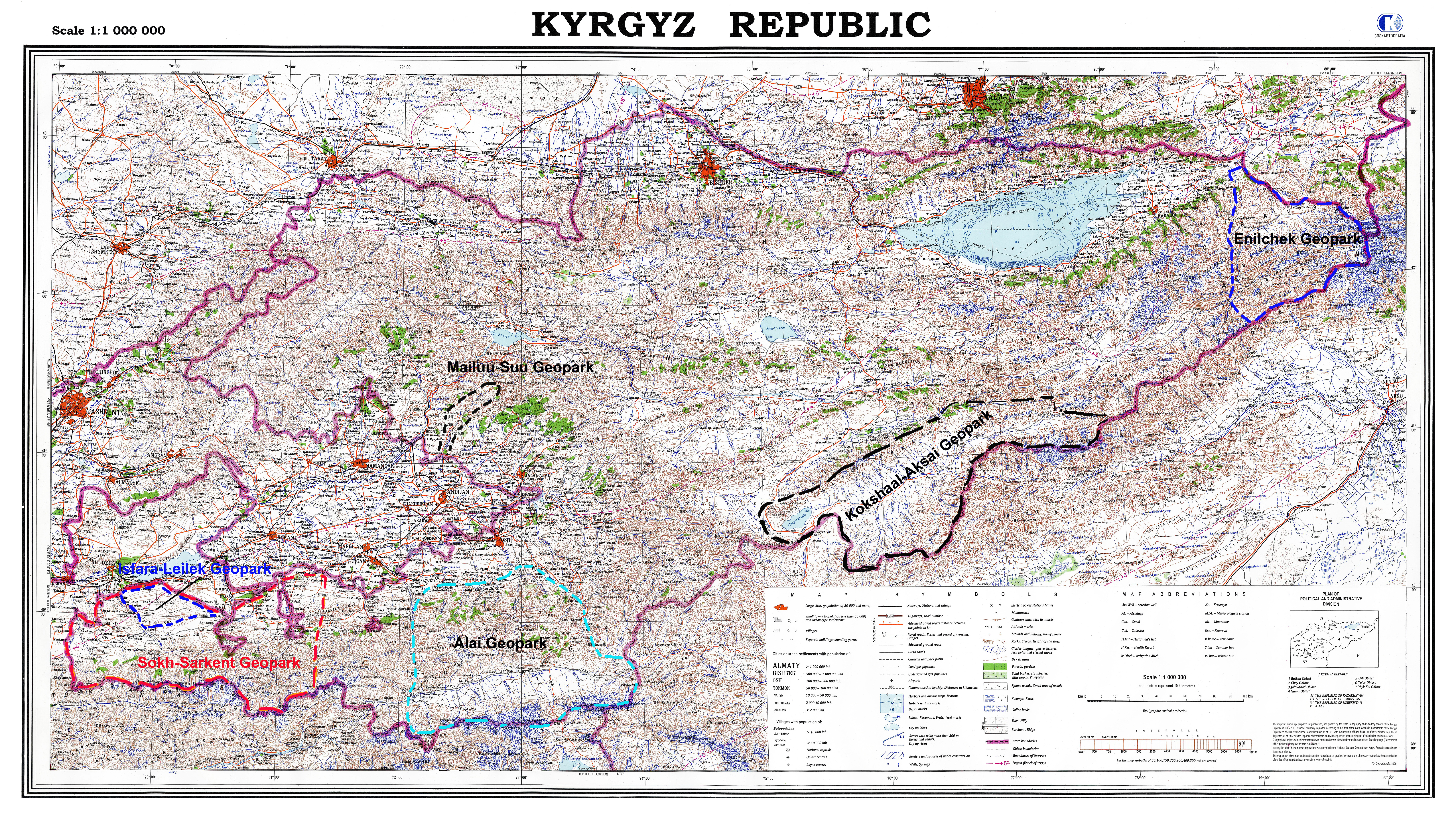
Kyrgyzstan has a huge potential for the creation of Global Geoparks under the UNESCO status. For example: in the east of the country of the Issyk-Kul region – the Enilchek valley with the surrounding mountain ranges, the Khan-Tengri and Pobeda peaks, the Sary-Jaz river valley (Central Tien-Shan). In the Batken region – the Sary-Too mountains, the Mydygen tract, the Kalcha-Bashi mountains (foothills of the Turkestan ridge). In the Jalal-Abad region, a potential geopark is the territory uniting the foothills and middle mountains of the Fergana and Chatkal ranges, the Buzbu-Too mountain and the savannah in the vicinity of the Kyzyl-Jar village.
The Alai Geopark could combine the geological heritage of the eastern part of the Alai ridge, the Alai Valley and the northern border of the Pamirs – the Zaalai ridge. In the Naryn region – the vicinity of the Naryn city, the Moldo-Too mountain range, the lake and the valley of the Son-Kul river, as well as the Karatal-Dzhapryk reserve.
The territory uniting the Ak-Sai valley, the Sary-Beles mountain range, the Kok-Kiya canyons and, of course, the Kol-Su lake can claim to be another excellent geopark.
Today, the creation of Geoparks is under the close scrutiny of UNESCO and with its support. Since 2002, there has been a special UNESCO program on National Geoparks (Global Network of National Geoparks). Since 2004, the established organization has been developing geotourism in every possible way, serving both educational and socio-ecological goals.
UNESCO Global Geoparks are territories that represent geological landscapes and contribute to the sustainable development of regions through local initiatives. They help in monitoring and raising awareness of climate change and natural disasters. In addition, many Geoparks help local communities develop strategies to mitigate the effects of natural disasters, ”the UNESCO statement said.
Kyrgyzstan, with a variety of landscapes, geological diversity, unique culture and natural resources, has very favorable conditions to become a part of the Global Geoparks network, where various geological sites with the status of World Heritage under the auspices of UNESCO can be protected as integral vast territories. This will allow Kyrgyzstan to become a progressive country in the Central Asian region supporting the Global Geoparks network program.
The UNESCO Global Geopark uses its geological heritage in relation to all other aspects of the region’s natural and cultural heritage to raise awareness and understanding of the key issues facing society in the context of a dynamic planet, climate change mitigation and disaster reduction, and poverty reduction.
By raising awareness of the importance of the region’s geological heritage in history and society today, UNESCO Global Geoparks give local residents a sense of pride in their region. The geopark is becoming an area where the creation of innovative local businesses, new jobs and high-quality training courses is stimulated, as new sources of income are generated by sustainable geotourism and the geological resources of the area are reliably protected by local residents.
Currently, in many civilized countries, Geoparks are of great importance for the development of tourism. Geoparks are a new modern concept in the preservation of natural landscapes with an emphasis on tourism development.
Global Geoparks are the foundation of all ecosystems and the foundation of human interaction with the landscape. A new bottom-up approach to managing Geoparks is becoming increasingly popular due to the positive and effective functioning of the Global Geoparks Network (GGN), with special support from UNESCO with selected Member States.
UNESCO is currently supporting Member States’ efforts to establish UNESCO Global Geoparks around the world, especially in developing areas without a Geopark, in close collaboration with the Global Geoparks Network.
In this regard, our Geological Society, using this opportunity, seeks to implement the idea of creating geoparks on the territory of Kyrgyzstan. We are confident that this is the only modern way to resist the ecological destruction of the natural heritage of the Tien-Shan.
Currently, the object of our research is the geological heritage in the Batken region with unique landscapes, stratotype geological sections and landforms. The geological heritage of the Batken region is an outstanding unique natural heritage of world significance.
Potential Geoparks, prospects for creation
Currently, our organization is taking an initiative to create Geoparks on the territory of Kyrgyzstan and possibly on transboundary territories.
Today, even without special expert assessments, the territories in the Batken region can be classified as a potential global geopark by combining: Sary-Too mountains, Madigen tract, Kalcha-Bashi mountains, Beli-Synyk, Kani-Gut cave, Karavshin gorge, and others geological objects into a single Alai-Turkestan geopark.
In the Osh region, you can also create a geopark, combining: Kozho-Kelen tract, the valleys of the Murdash, Abshir-Sai, Ak-Buura rivers, the Kyrgyz-Ata tract, the Alai valley, Lenin peak, the Chon-Alai ridge gorges and other objects, into a single Alai Geopark.
Over time, taking into account the geographical location, commonality of landscapes, cultures and other aspects, the unique territories of already existing Geoparks can eventually be combined into Global Geoparks.
In the Jalal-Abad region, the Mailuu-Suu river valley can become an actual natural and technogenic geopark, as a vivid example of the development of civilization through the extraction of minerals and, as a result, the formed environmental threats. The creation of such a geopark stimulates the development of small towns in Kyrgyzstan, where in the recent past, minerals were mined, and today these settlements are left to their own devices.
Thus, the future belongs to Geoparks. Geoparks are areas of active ecological tourism and, as a result, of the preservation of the values of the nature of Kyrgyzstan and cross-border areas.
Moreover, Kyrgyzstan occupies a large, western part of the Tien-Shan mountain system. which fulfills the unifying role of adjoining Tajikistan, Uzbekistan, Kazakhstan and China. Thus, this is a prerequisite for solving the problems of preserving natural heritage in vast natural transboundary territories.
In this regard, the work of local experts, who, guided by local legislation, should conduct a self-assessment of Geoparks, taking into account the UNESCO criteria for evaluating Global Geoparks, should become a practical step on the way to creating Geoparks in Kyrgyzstan. Local Geoparks need to be assessed from a perspective, as part of UNESCO Global Geoparks, which are World Heritage Sites, based on common criteria for assessing World Heritage.
Thus, guided by the UNESCO World Heritage criteria and the concept of a Geopark, which are based on both natural and cultural characteristics of a particular area, a Geopark must be an outstanding asset and meet the main criteria, which are presented below:
That is, the Geopark must contain objects of international importance that meet the following criteria:
- Natural heritage criteria
N1 – represent outstanding examples of the reflection of the main stages of the evolution of the Earth, including traces of ancient life, significant geological processes that continue to occur in the development of forms of the earth’s surface, significant geomorphological or physical-geographical features of the relief;
N2 – represent outstanding examples of important ongoing geological processes, biological evolution and human interactions with the natural environment;
N3- include unique natural phenomena or areas of exceptional natural beauty and aesthetic value;
N4 – include natural areas of greatest importance and significance from the point of view of preserving biological diversity, including areas of endangered species, representing an outstanding world heritage in terms of science and nature conservation;
N5 – represent the largest and most representative natural habitat for endangered or universally valuable animal and plant species. - The cultural criteria for World Heritage include the following:
C1 – the object must represent a unique or at least outstanding evidence of an extinct civilization;
C2 – reflect the importance of the relationship of human values that exist over a period of time or within a specific cultural area;
C3 – be unique or at least exceptional evidence of a cultural tradition or civilization that exists or has disappeared;
C4 – represent an outstanding example of traditional human settlement, land use characteristic of a particular culture (or cultures), interaction between humans and the natural environment, especially if there is a danger of destruction under the influence of irreversible changes.
Also, the object must be protected, have a management system, and meet the criteria of authenticity and integrity. The geopark is characterized by the same features as other territories classified as attractions, but the priority is still given to the geological direction.
Based on these criteria, it can be seen that Global Geoparks promote links between the geological heritage and all other aspects of the natural and cultural heritage of this area, which clearly demonstrates the example when the geological structure with its relief and ongoing geoprocesses is the basis for all ecosystems and the basis of human interaction with landscape. For example, the relief due to the geological and structural structure, along with climatic features, in turn predetermines the habitats for certain biological species, or creates conditions due to its geological features and climate for the existence of a certain flora.
Thus, the Geopark is the foundation for the global (integrated) preservation of all ecosystems that are formed from natural objects, objects of material culture and natural processes occurring in the territory of the Geopark. A Geopark is an area of integrated conservation and holistic management of a Geopark, and therefore all natural and cultural values.
Geopark in Batken region – future UNESCO Geopark
According to our experts, one of the most promising regions for creating a Geopark in Kyrgyzstan is the Batken region. On this territory there are objects that are natural heritage of world importance.
World Heritage is monuments, ensembles and sites of outstanding universal value, that is, a value “so exceptional that it transcends national boundaries and is of universal value for present and future generations of all mankind.”
Such objects on the territory of Batken region are geological sections reflecting the continuous course of the geological history of the Earth. These sections are characterized by the presence of a complete continuous boundary between some geological formations (layers) of the Paleozoic period. Such a structure of the sections creates all the conditions for their inclusion in the list of world natural heritage, and from the point of view of geology, these places have every reason to get the “Golden Nail” – a reference geological section, or a stratigraphic boundary between geological layers of different ages.
This continuous boundary makes it possible to reconstruct without gaps the geological evolution of the region where the Golden Nail section is located.
In addition to unique geological sections, outstanding geological objects are located on the territory of the region, forming landscapes of a very aesthetic appearance.
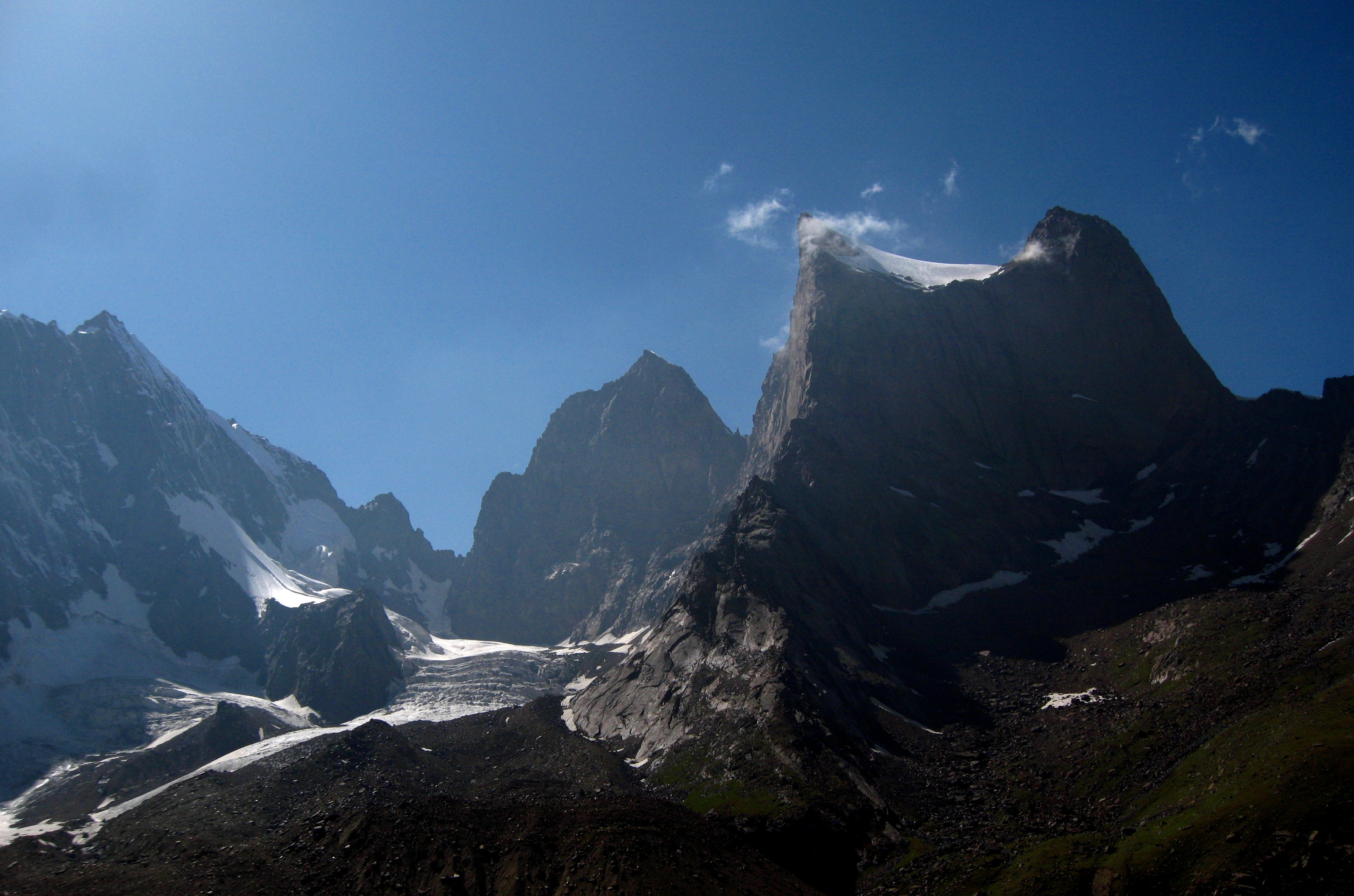
In this regard, the Tien-Shan Geological Society promotes the territory of the Batken region, including objects of geological and cultural heritage, as a UNESCO Geopark. According to our experts, it is necessary to create a Geopark on the territory in the Ak-Su-Sokh interfluve. The Geopark should include the following geological heritage sites: the Madigen mountain tract, the Sary-Too mountains, the Kalcha-Bashi mountains, the ancient Kani-Gut cave mine, the northern slopes of the Takta-Boz limestone ridge, the Tash-Rabat tract, the Kara-Tau mountains , Beli-Synyk mountain range and other objects. Photo of the geological heritage of the Batken Geopark
Along with the geological heritage, historical sites with cultural heritage are located on the territory of the Geopark. They have a direct connection or constitute a single whole geological heritage. For example, such as ancient mines, quarries, mines and adits.
The Geopark’s territory is distinguished by special contrasts, from semi-deserts to nival landscapes. Sokh canyon with historical sites located in its vicinity is of certain importance as a natural and cultural heritage.
The Geopark is a habitat for rare and endemic species of fauna and flora. This is a single territory, interdependent ecosystems. The development of common material culture and, accordingly, monuments of material culture are associated with the geological heritage and individual forms of relief.
Thus, the territory of the future Geopark meets the natural criteria of natural and cultural heritage: N1, N2, N3, N4, N5. With regard to cultural heritage, the united territory meets the criteria: C1, C2, C3, C4.
In addition, the future Geopark has the prospect of cross-border development with neighboring Tajikistan.
The relief and outstanding geological formations are natural monuments, which together represent one of the unique geological heritage not only of Kyrgyzstan, but of the Eurasian continent. The cultural and historical significance of the region is associated with history and archeology, describing the development of civilizations along the Great Silk way, including this territory.
Below is an example of assessing the characteristics according to the mentioned criteria of the Ak-Su – Sokh Geopark, which define the territory as a UNESCO Geopark.
Assessment of Ak-Su – Sokh (Batken) Geopark according to UNESCO criteria, development prospects
The assessment is based on UNESCO criteria, and also takes into account local characteristics that characterize values, the uniqueness of the geological heritage (N1, N2, N3), which, in fact, determines habitats, ecosystems (N5) and the development of material culture (C2, C2, C3).
Our experts also analyze the management of the state park, socio-economic feasibility and the possibility of developing ecological tourism.
One of the fundamental practical assessment tools is the Red Data Book of Kyrgyzstan. Biodiversity listed in the Red Book is an important criterion (N4, N5) to justify the Geopark territory. A large number of animals in need of protection live within the described territory, as well as animals that become or may become dependent on limiting factors, which is the main criterion in assessing the Geopark. In this way, geological landscapes act as habitats for biodiversity. This is a fundamental concept when a certain geological structure, history of geological development, relief and geographical conditions determine the life of certain species of flora and fauna.
Tourism is a fundamental concept in the development concept of Geoparks
There are many concepts of a Geopark. In order to make it completely clear what it is, there is a UNESCO classification. There must be a geological object in the Geopark. This is not necessarily some kind of natural phenomenon, that is, landscapes, for example, but it can also be an ancient or old geological development. A certain tourist complex is being created around this object and its visit is completely free. But, as a rule, on the contrary, a fee is charged for excursions, because the business makes money from it. Therefore, a program is needed, according to which, first of all, it is necessary to create a register of those objects that can qualify for the creation of a Geopark. These are objects of geological and cultural heritage. But, of course, opportunities and conditions are needed for the development of ecological tourism.
Batken region is a territory where tourism is at an early stage of development. And this is a big plus from the point of view of minimal risks for a conflict of interests between business and the population, not spoiled by tourism.
Is the Golden Spike a museum or a tourist attraction?
The places where the geological sections with the “Golden Spike” are located must be designed in such a way that these places become more and more popular among tourists and arouse a sense of pride among local residents. For example, in China, the places where Golden Spike exist are very popular. Near these places they create the appropriate infrastructure, and this brings profit to local residents, but with an emphasis on nature conservation. Children, schoolchildren, students, and the scientific community also come there. We need to turn our cuts into something similar. If we want the republic to follow a non-industrial path of development, and now this is a necessity, then it is necessary to turn the geological heritage into a popular tourist resource.
An important and basic component of a Geopark is the geology of the territory. Geology means relief, geological sections, paleontological sections and finds, individual landforms and outstanding landscapes, caves, mines, geological structures.
According to the UNESCO criteria, the Geopark should have outstanding geological formations that attract tourists and researchers.
The Sary-Too, Kalcha-Bashi mountains, Madygen canyon and other geological formations are highly characteristic reflection of one of the largest periods of the Earth’s evolution – the Mesozoic era (MZ). Natural formations are a representative and significant example of current geological processes, and the associated biological evolution and interaction of man and his natural environment. They are geological phenomena, highly remarkable places, as the largest ecosystems, landscapes of extraordinary beauty. Geological features are associated with unique samples of joint creations of man and nature, which refers to the ancient cave mine Kani-Gut and associated ancient metallurgical complexes located throughout the Geopark.
It is proposed to understand the described territory as Madigen – it is an area with extensive development of Mesozoic formations, creating outstanding natural landscapes. Madigen is a striking and classic example of the Mesozoic (MZ) period on the Eurasian continent. The presence of mineral chemical elements in the geological layers, their subsequent oxidation and metamorphization, make these mountains colorful and attractive to tourists.
Madigen is known in the world paleontological science as an area with rare representative representatives of the leading and rare representatives of the fossil fauna. Single specimens of some species of thanatocenoses were found here, which made it possible to reconstruct the paleogeographic and geological events that took place here millions of years ago and which became outstanding discoveries that made it possible to reconstruct the geological history of vast territories of the Earth.
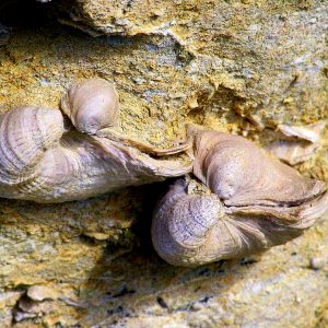
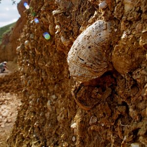
The most widespread representatives of the fossil fauna are bivalve mollusks of the Bivalvia class. The thick layers formed by representatives of this species testify to their mass extinction in the Triassic, Cretaceous and Paleogene periods.
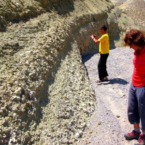
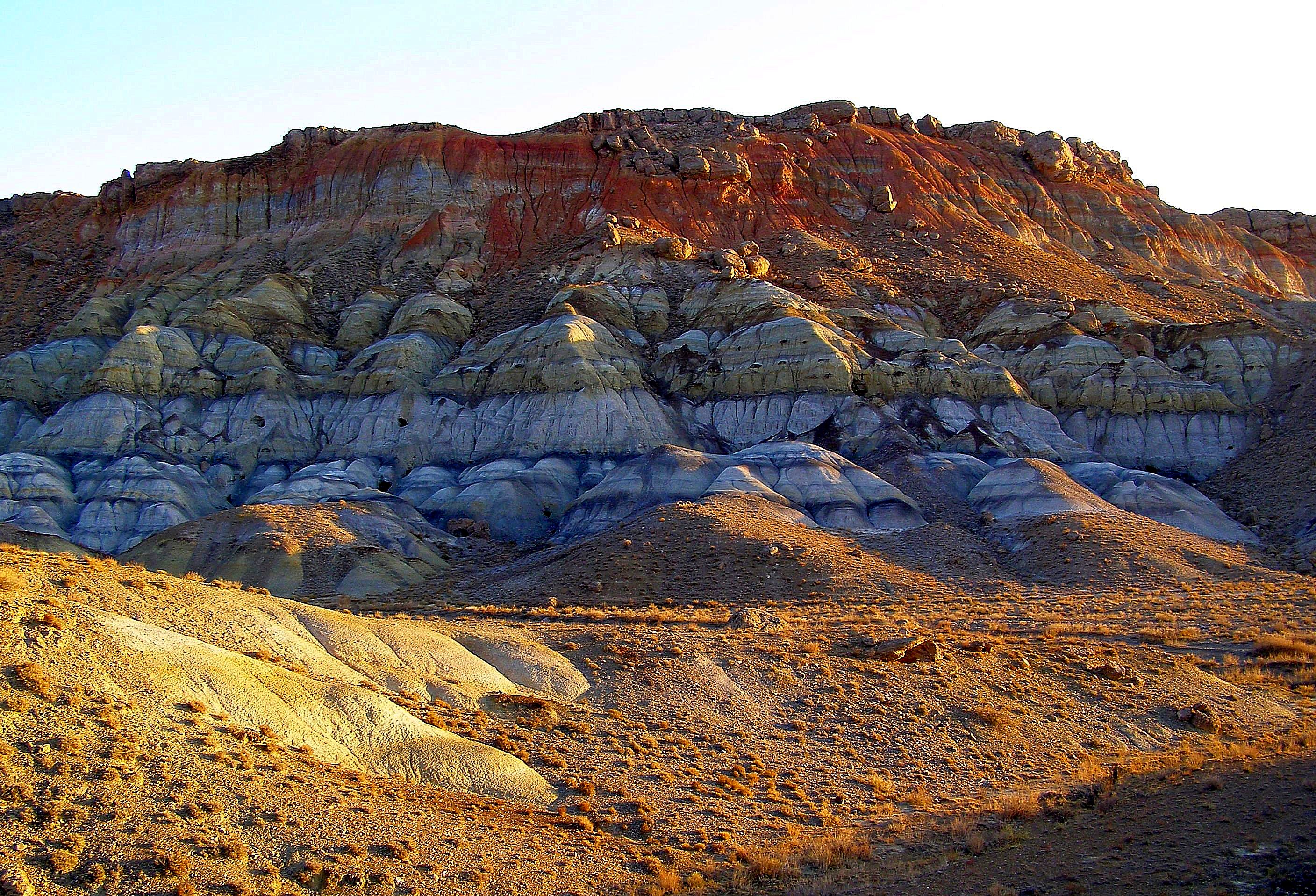
Pic. -Triassic fossil formations in Madygen, Batken region
It is important to note the worldwide fame of this area for the unique and unique paleontological finds in the world.
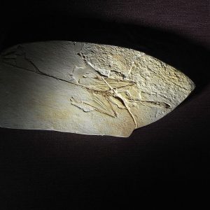
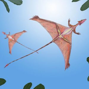
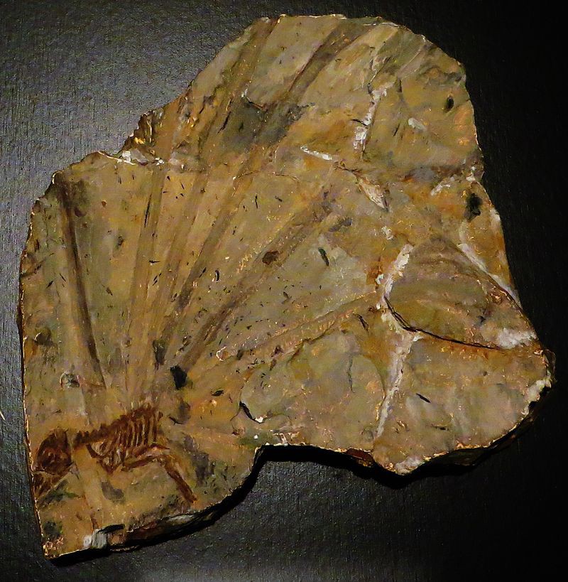
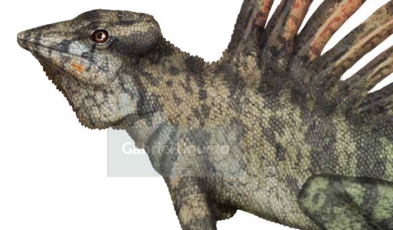
For example: Sharovipteriks (Sharovipteryx mirabilis) – lived during the Triassic period 242-227 million years ago. One of two species in the Sharovipterygidae family and the only known representative of the Sharovipteryx kind. Known for the only fossil found in the Madygen tract, it is therefore assumed that he lived in the territory of present-day Central Asia.
The figures show the reconstruction of Sharovipteryx (Sharovipteryx mirabilis). The print was found in the Madigen tract (Batken region)
The main representatives of the fossil fauna of the Madygen formation are the following:
Cartilaginous fishes:
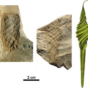
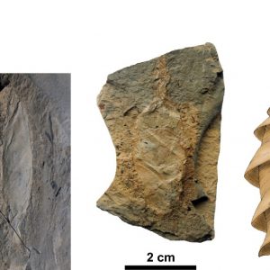
- Palaeoxyris, Palaeoxyris Alterna;
- Fayolia, Fayolia Sharovi
- Representatives of ancient sharks – Lonchidion Lonchidion ferganensis
Amphibians:
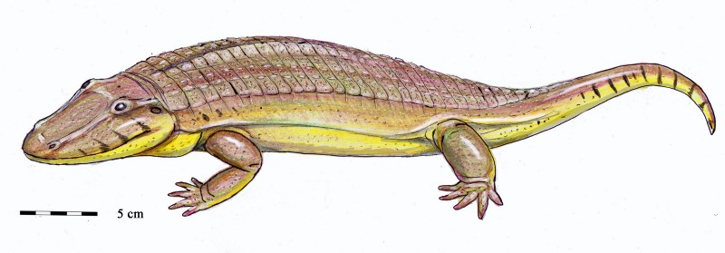
- Madygenerpeton Madygenerpeton pustulatus
- Triassurus sixtelae
Reptiles:
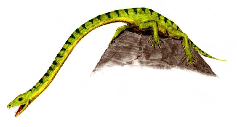
- Kyrgyzsaurus bukhanchenkoi
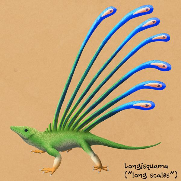
- Longisquama insignis
- Sharovipteryx mirabilis
- Madysaurus sharovi
And this is only a small part of the representatives of the fossil fauna and flora of the Madygen formation.
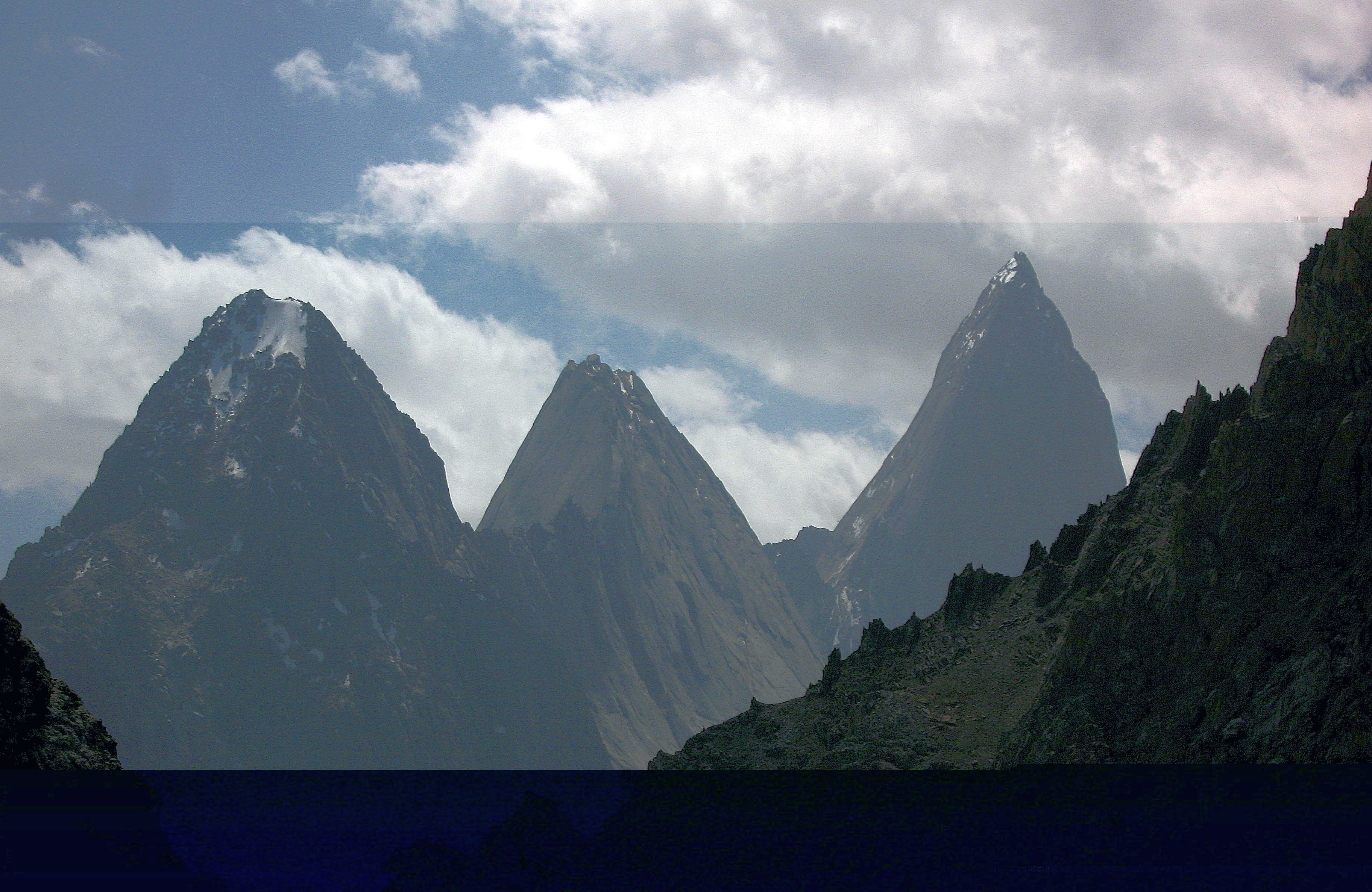
Without any doubts, the aforementioned geological structures of Madygen, Kalcha-Bashi, Beli-Synyk and Sary-Too are an excellent educational, scientific and practical natural testing ground for the study of geological science, paleontology; this is an open-air geological museum, which should be used for the education of the younger generation and ecotourism, which is fully consistent with the principles of the UNESCO.
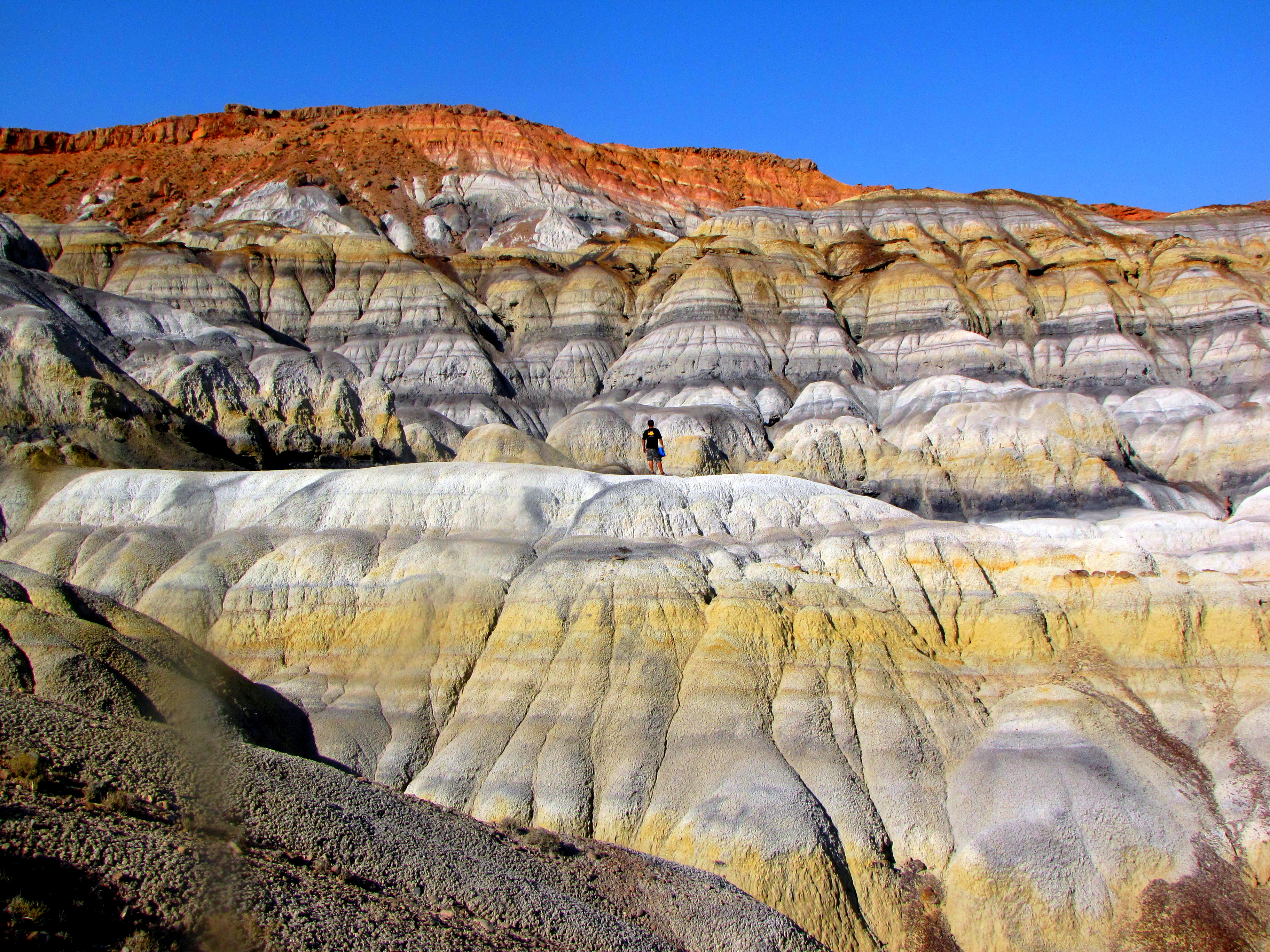
Pic. – The mountains of Sary-Too are an excellent testing ground for geological education and aesthetic enjoyment of nature.
The natural values of the Geopark are complemented by the ancient cave mine Kani-Gut, as an outstanding example of the joint creations of man and nature. The ancient underground mine witnessed the 1500 year history of the region, the evolution of mining technologies on the Great Silk Road, the stages of development of the metallurgical industry, as well as the barbaric attitude to historical artifacts during exploration works in the middle of the 20th century, which serves as a vivid negative example in educational and cognitive aspects of what a person should not do.
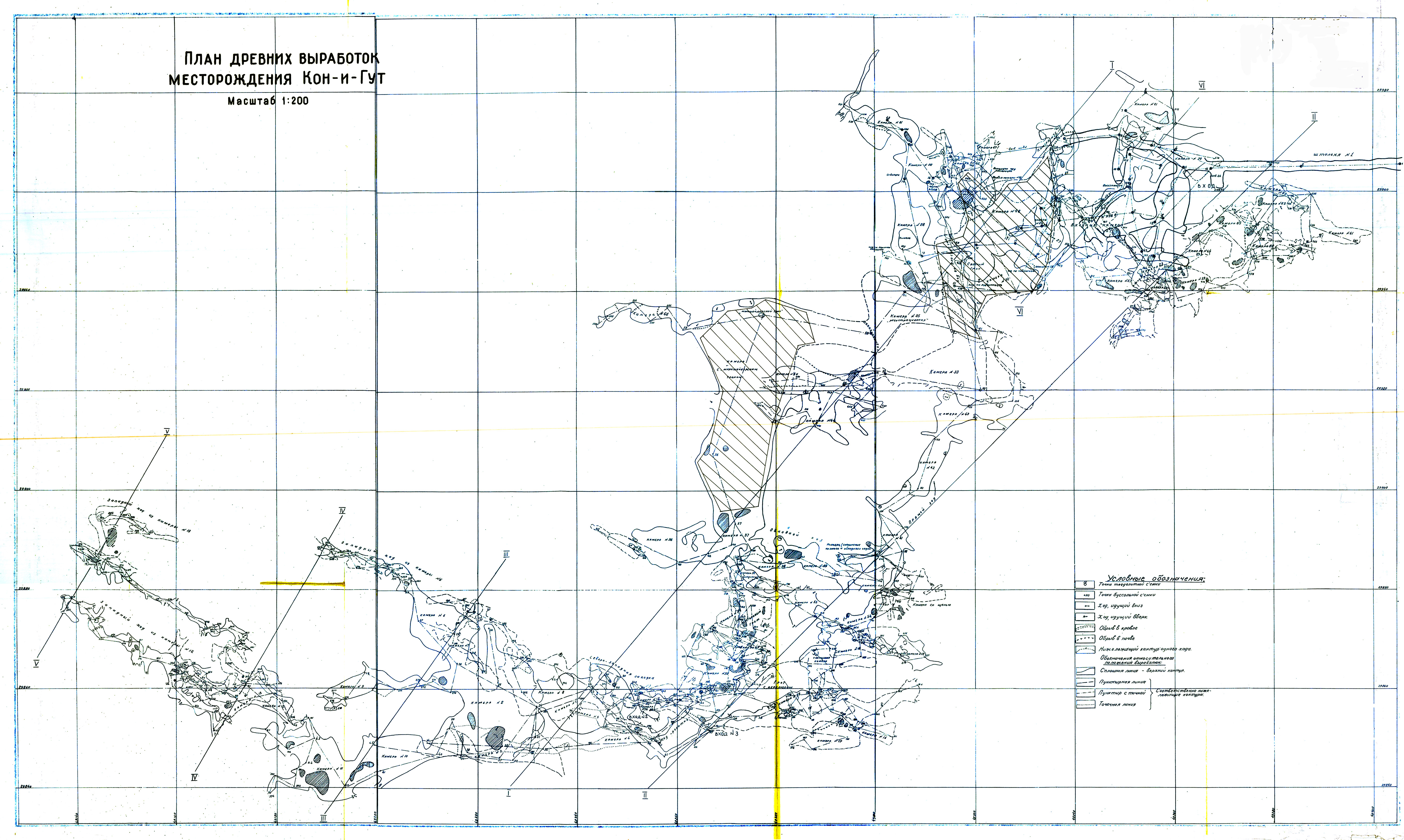
Pic. – Plan of the ancient workings of the Kani-Gut cave
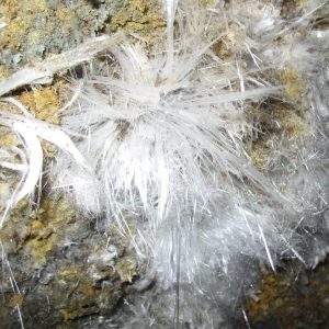
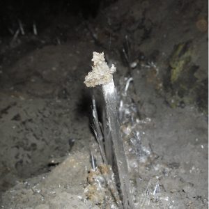
As a result, Kani-Gut became a famous and attractive tourist destination. The ancient cave mine is included in the register of Specially Protected Natural Areas of Kyrgyzstan as an object of history. It will also be unfair to disregard the historical artifacts in the form of ancient smelting furnaces directly related to the cave and its use, in which silver-lead ores were mined. The uniqueness of the cave mine lies in the fact that it has preserved ancient artificial galleries of different historical eras. The length of all cave passages is about 6 km. The ore was used throughout Central Asia and beyond. In addition, in the cave one can observe the formation of gypsum crystals. The cave is also a habitat for rare bats.
Fig. – Gypsum crystals in the Kani-Gut Cave
Therefore, Kani-Gut reflects the natural, traditional for a particular era, human settlement or the results of subsoil use, and its surroundings – geological epochs in the development of the Earth, the development of relief forms or natural geological processes;
The remains of the preserved ancient metallurgical complexes are located almost throughout the semi-desert part of the Geopark, which successfully fit into the local landscape creating excellent conditions for educational excursions.
All these features determined the criteria that strengthen the position of the described territory as a Geopark in order to preserve all the components of the natural complex. These criteria are the C3 and C4 we have adopted in this article. Thus, the Ak-Su – Sokh interfluve must be declared a Geopark, which in the long term, according to UNESCO criteria, should be included in the Global Geoparks network under the auspices of this organization. This will help preserve unique natural and cultural sites.
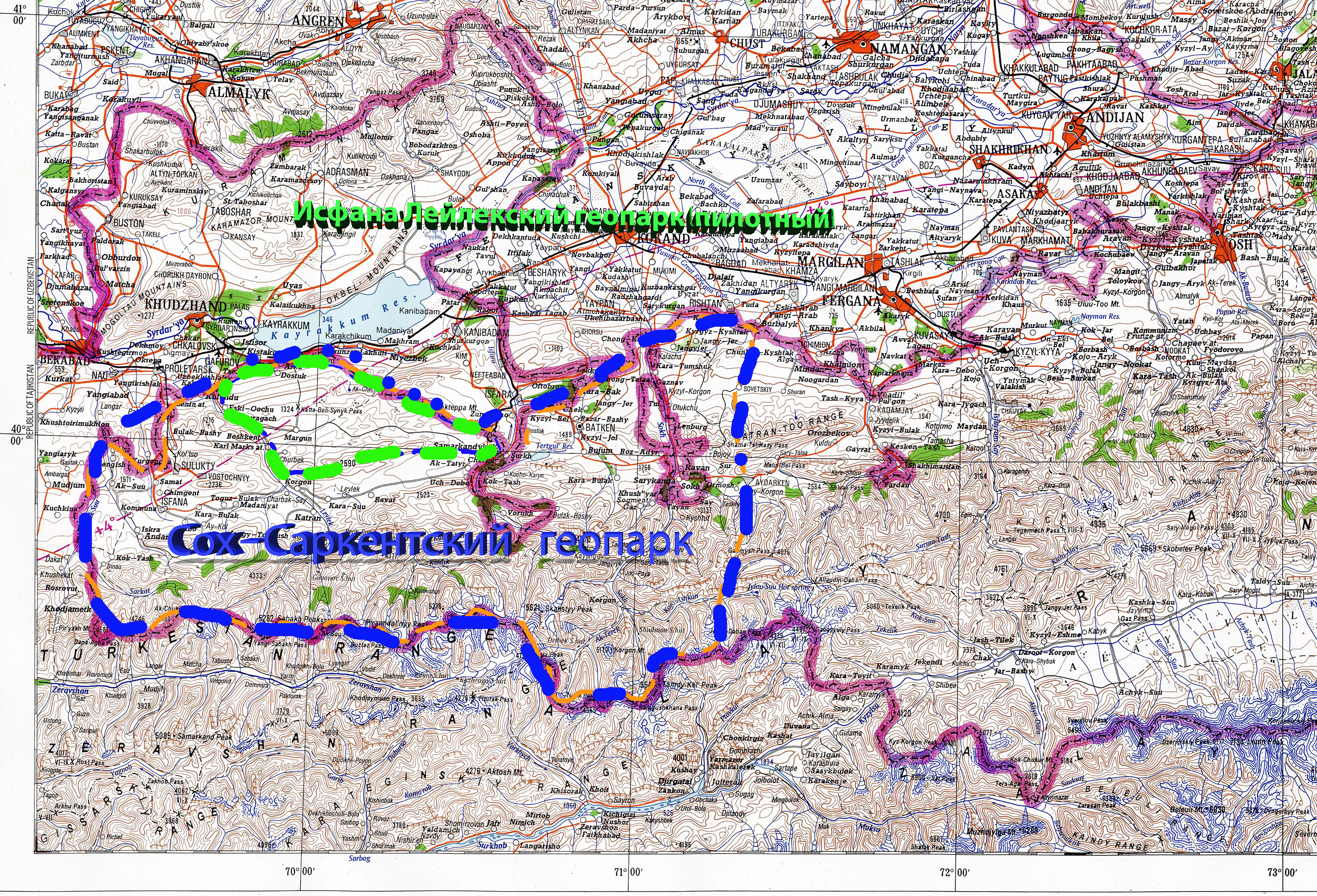
The current one – the Sarkent National Park and the Aigul-Tash botanical reserve – can be included in the global geopark. The Geopark will also include objects of material and historical heritage. Such as the Sel-Unkur cave in the area of the village of Khaidarkan, where scientists have discovered the earliest paleontological site inhabited by the most ancient man in the territory of Fergana. Here were found classic stone tools – hand axes, choppers, bifaces, as well as parts of a human skull, dating back to 1-1.5 million years. They can still be seen in the exposition of the State Museum of History at the Academy of Sciences of Uzbekistan.
Schematic map – Prospective territories of Ak-Su – Sokh Geopark or (Sokh-Sarkent) Global Geopark. Batken region, Kyrgyzstan
The settlement of Khaidarkan and the already inactive mines for the extraction of minerals will logically enter the global geopark directly as an object of mining production and mining. Which can be used for education and research.
Another historical site of which, unfortunately, is currently not supported by the state, which leads to its decline as a cultural and historical site. Fortress Khudoyar-Khan, and other objects of material culture of the Maveranakhr era and other historical periods.
Of course, the Sokh River Valley with its impressive canyon and archaeological sites cannot be ignored by the Geopark.
In the south, the global geopark will include the northern foothills of the Turkestan ridge with the famous peaks Pyramidalny (5509 m), Ak-Suu (5355 m), Slesov (4240), several glaciers and the famous valley of the Karavshin River, which together represent a Mecca for climbers and numerous tourists who call this area “Asian Patagonia”.
Batken region is an agricultural region with very attractive natural resources. Almost harmoniously with nature, the culture and human activities associated with the development of the territory developed and are developing. Thus, the people living here should be the main “directors” or marketers in the development of the Geopark. Ethno culture is an obligatory component of the Geopark.
This area is characterized by desert and semi-desert landscapes. The rare oases associated with the springs that drain the limestone massifs of the surrounding desert valleys not only provide an opportunity to enjoy nature, creating magnificent landscapes, but are also water resources that the region is naturally deprived of. Therefore, their preservation for the purpose of high-quality and safe water supply remains today one of the urgent problems in the concept of conservation and management of water resources.
The creation of a Geopark will allow the local population to realize themselves, using the natural heritage of the region, thereby being a part of this heritage and developing harmoniously, preserving traditions, culture and the environment.
The Geopark should promote international cooperation between areas with geological heritage of international importance through a bottom-up approach to Geopark management, conservation, community support, heritage promotion and sustainable development of these areas. In our opinion, this is a powerful incentive for the development of ecological tourism with the involvement of the local population in the process.
For the Batken region with its rather low socio-economic indicators, the creation of a Geopark will give a tangible impetus to its development. Geopark is a unified integrated approach to the preservation of natural and cultural values.
- So, the concept of Geopark development is:
– Socio-economic significance – employment of the local population in preserving their own values;
– Development of ecological tourism and related business in the field of tourism and environmental protection;
– Simplification of the management of Specially Protected Areas. Thus, the geological foundation of the park creates the basis for the conservation regime for all natural and material components of the environment.
– Improving the attractiveness of the region for ecotourism, research, education.
– Preservation of natural, historical, material and cultural values.
An important step in the Geopark concept is the country’s aspiration to become part of UNESCO Global Geoparks. Thus, Global Geoparks are unified, united geographic areas where the management of objects and landscapes of international geological importance is carried out on the basis of a holistic concept of protection, education and sustainable development. UNESCO Global Geoparks use the geological heritage in connection with all other aspects of the natural and cultural heritage of an area to raise public awareness and better understanding of the key issues facing society in the context of the dynamic development of the region where we live and planet Earth as a whole.
A Global Geopark should be areas with a governing body that has a recognized status under national law. A Global Geopark should actively engage local communities and indigenous peoples as key stakeholders in the Geopark in order to develop ecotourism and, as a result, the socio-economic conditions of these peoples.
In partnership with local communities, a joint management plan should be developed and implemented, taking into account the social and economic needs of the local population, ensuring the protection of the landscape in which they live and the preservation of its cultural identity. It is recommended that all relevant local and regional actors and authorities are represented in the governance of a Global Geopark. The knowledge, practices and management systems of local and indigenous peoples must be incorporated, along with scientific knowledge, into the planning and management of the area. Therefore, the Global Geopark must comply with local and national laws regarding the protection of geological heritage.
Connecting Kyrgyzstan to the movement of global Geoparks, will increase the country’s image, expand international cooperation, create conditions for support from the UNESCO Global Geoparks program, and most importantly, will allow a comprehensive approach to the preservation of natural and cultural heritage.
Geopark today is a territory promoted in the media and on Internet sites, which serves as a place of pilgrimage, research, education, tourism and recreation. It provides the state with considerable assistance, being not only an additional source of income and a new direction in the development of tourism, but also an effective way of protecting nature, improving the quality of life of the local population, and solving social problems by creating new jobs.
The culture of the indigenous population corresponds to the main idea of the Geopark. On the territory of the Ak-Su (Batken) Geopark, there are many objects of “inanimate nature” (rocks, mountains, stones, caves, etc.), which are sacred places. The people who lived on this territory not only preserved these objects for posterity, but also laid the foundations for a careful attitude towards them, interest in the properties of these objects. Popularization of this phenomenon is one of the ways to manage the Geopark from the bottom up.
We invite experts in geological heritage, international organizations and donors to cooperate to create the first Geopark in Central Asia, which has all the properties of a UNESCO Geopark.
The territory of promising Global Geoparks Kyrgyzstan.
